

Cities have faced a host of shocks throughout history. Wars, natural disasters, pandemics, and technological shocks have all impacted city structure (i.e. the spatial distribution of economic activities within cities). In particular, a city’s structure would change substantially if a central location in the city with the highest population and employment is destroyed by a large negative shock such as bombing. However, there remains substantial debate about whether city structure is resilient to such large shocks and what mechanisms are behind this resilience (Glaeser 2022).
Although there is an influential line of existing research on wartime bombing in the economics literature (e.g. Davis and Weinstein 2002), two important challenges remain in understanding the mechanisms that underlie the resilience of city structures. First, we rarely observe a large shock to city structure while having access to spatially granular data on economic activities over a long period of time. Second, we need a quantifiable model of the dynamics of internal city structure that allows us to disentangle the mechanisms underlying the resilience of city structure.
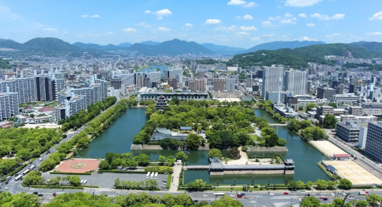
In a new paper (Takeda and Yamagishi 2024), we present new theory and evidence on the resilience of city structure by analysing the atomic bombing of Hiroshima. We begin by assembling a new dataset on Hiroshima’s economic activity at a fine level of spatial disaggregation, covering both before and after WWII. Figure 1 shows the variation of the destruction across blocks.
Figure 1 Destruction of the atomic bombing in Hiroshima


Note: This shows a map of Hiroshima at the time of the bombing, along with block-level data on the fraction of completely destroyed buildings and the epicenter (Hiroshima City Government 1971; Takezaki and Soda 2001). Remote islands (Nino-shima; Kanawa-jima; Touge-shime) are omitted for better visibility.We use as the background image the 1950 topographic map taken from the Time Series Topographic Map Viewer of Japan (Tani 2017, https://ktgis.net/kjmapw/).
In the period before WWII, Hiroshima had a monocentric city structure, with the highest employment and population densities concentrated in the city centre. In the immediate aftermath of the atomic bombing, there was a complete reversal of this monocentric city structure, with the city centre devastated and the highest population densities found in the outskirts. Nevertheless, by as early as 1950, a monocentric city structure had re-emerged, with the highest concentrations of employment and population densities in the city centre. Figure 2 illustrates this pattern.
Figure 2 Population density by distance to the city centre in Hiroshima


Note: The figure shows the local polynomial regression of the log population density on the distance to the CBD for different years. To eliminate the effect of changes in the total population, we normalise the total population each year to 100,000. The predicted population distribution of 1950 is computed based on the 1936 population distribution, assuming that each block experienced an annual population growth rate equal to the pre-war (1933–1936) rate.
Exploiting the detailed data, we also provide evidence against a number of other potential explanations, including fundamental location characteristics (first nature) and built and man-made environments, such as transportation access and land use regulation. Our findings suggest that the observable location characteristics we control for are unlikely to account for the strong recovery of the city centre and the re-emergence of the pre-war city structure. Taken together, the following two mechanisms are considered to explain the recovery: first, there could be some unobservable locational advantages in the destroyed city centre that persisted through the bombing; and second, individuals may have expected the recovery of the city centre, and the incentive to live and work in the city centre again arises from agglomeration forces due to the expected high density, as in the pre-war period.
Guided by the reduced-form results, we develop a new dynamic quantitative model of internal city structure that incorporates commuting, forward-looking location choices of workers, durable floor space, migration frictions, agglomeration forces, and heterogeneous location fundamentals. The city of Hiroshima is embedded in a larger economy that provides a reservation level of utility. The city consists of a discrete number of locations that correspond to city blocks in the data.
Blocks differ in terms of their productivity, amenities, land endowment, and bilateral commuting costs. Productivity depends on both location fundamentals (e.g. access to natural water) and agglomeration forces, as determined by the surrounding concentration of employment. Amenities depend on both location fundamentals (e.g. scenic views) and agglomeration forces, as determined by the surrounding concentration of residents. Bilateral commuting costs depend on the observed transport network, including both private and public transportation.
There is a single final good that is produced using labour and floor spaces under conditions of perfect competition. There are competitive developers who supply floor spaces in each block, which defines the dynamics of floor spaces. Workers are endowed with one unit of labour that is supplied inelastically. They commute from their residence to their workplace subject to commuting costs, as in Ahlfeldt et al. (2015) and Monte et al. (2018).
Worker mobility decisions are assumed to take a Calvo form, such that each period, there is a Poisson probability that a worker receives an opportunity to change their residence and workplace block. Upon receiving a moving opportunity, workers draw idiosyncratic preferences for each residence-workplace pair in Hiroshima and the wider economy and choose the pair that offers the highest utility. This introduces dynamics and gradual adjustment in worker mobility decisions, as in Caliendo et al. (2019), within a city.
The model is quantified using the observed data on population, employment, floor spaces, and bilateral travel times in Hiroshima. The worker commuting and mobility parameters are calibrated using the historical data for Hiroshima. Given these commuting parameters, the model can be inverted to recover unobserved productivities and amenities in each location, which in turn depend on agglomeration forces and location fundamentals.
Given these solutions for productivities and amenities, the agglomeration parameters are estimated. An important advantage of the estimation procedure is that it is robust to multiple equilibria, since it conditions on the observed equilibrium in the data. Given this observed equilibrium and the assumed orthogonality condition, the model parameters can be estimated regardless of whether or not there could have been another equilibrium.
One of the key quantitative findings is that strong agglomeration forces are required to explain the re-emergence of the city centre in the aftermath of the atomic bombing. When there is no agglomeration force, the model no longer predicts the recovery of the population and employment in central Hiroshima (Figure 3a). Furthermore, these strong agglomeration forces imply the existence of multiple equilibria in the model. Indeed, we show that there exists another possible rational expectations equilibrium, in which economic activity could have remained concentrated in the outskirts of the city, instead of coalescing around the pre-war centre (Figure 3b). This provides empirical underpinnings to the discussion of ‘history’ versus ‘expectation’ – the initial conditions determined by history can be overcome by expectations when agglomeration forces are important – which is traced back to Krugman (1991), Matsuyama (1991), Fukao and Benabou (1993), Baldwin (2001) and Ottaviano (2001).
Figure 3 Population density of Hiroshima in different scenarios


Note: Each figure plots the log population density with local polynomial regressions of each on the distance from the CBD. We run three separate regressions: one for the observed 1945 population and employment densities (small dashed line), one for the observed 1950 population and employment densities (long dashed line), and one for the inferred 1950 population and employment densities in an alternative equilibrium (solid line) when there are no agglomeration forces in productivity and amenities (panel a) and individuals expect that the pre-war CBD will not recover and an alternative block located at the vertical dashed line will grow. Each dot represents a block, with different colours for the predicted density and the observed density. In panel b the location with the growing population and employment density is labelled “Counterfactual CBD”.
Our quantitative findings provide further empirical support for the idea that the re-emergence of the pre-war city structure is driven by a coordination of expectations around this focal point. A key implication derived from the analysis is that the resilience of cities in the face of large-scale shocks depends critically on the expectations of agents. Therefore, coordinating agents’ expectations about the city structure with public policymakers would aid the reconstruction of war-torn cities, improve urban revitalisation efforts, and inform planning for future shocks.
Source: cepr.org
